September 24, 2019
FOR IMMEDIATE RELEASE
CloudAhoy 6.0 – CFI Assistant Provide Automatic Scoring
CloudAhoy introduces a Pro version
Lexington, MA (September 24, 2019) — CloudAhoy announces the release of CFI Assistant, for automatic scoring of pilot performance. The CFI Assistant is included in CloudAhoy Pro, along with additional advanced features for post-flight debriefing. It is released as part CloudAhoy 6.0 which has numerous new capabilities and enhancements.
“Automatic scoring of pilots’ performance has been in our vision since the very beginning of CloudAhoy. We believe that data-driven, objective, automated scoring of a pilot’s performance provides valuable feedback to any pilot at any level, for flight training and for proficiency of experienced pilots.” says Chuck Shavit, the founder and CEO of CloudAhoy. “The CFI Assistant certainly does not replace a human flight instructor – flight instructors are indispensable – but specific aspects of pilot performance and proficiency are objective and measurable, and that’s where the CFI Assistant comes in.”
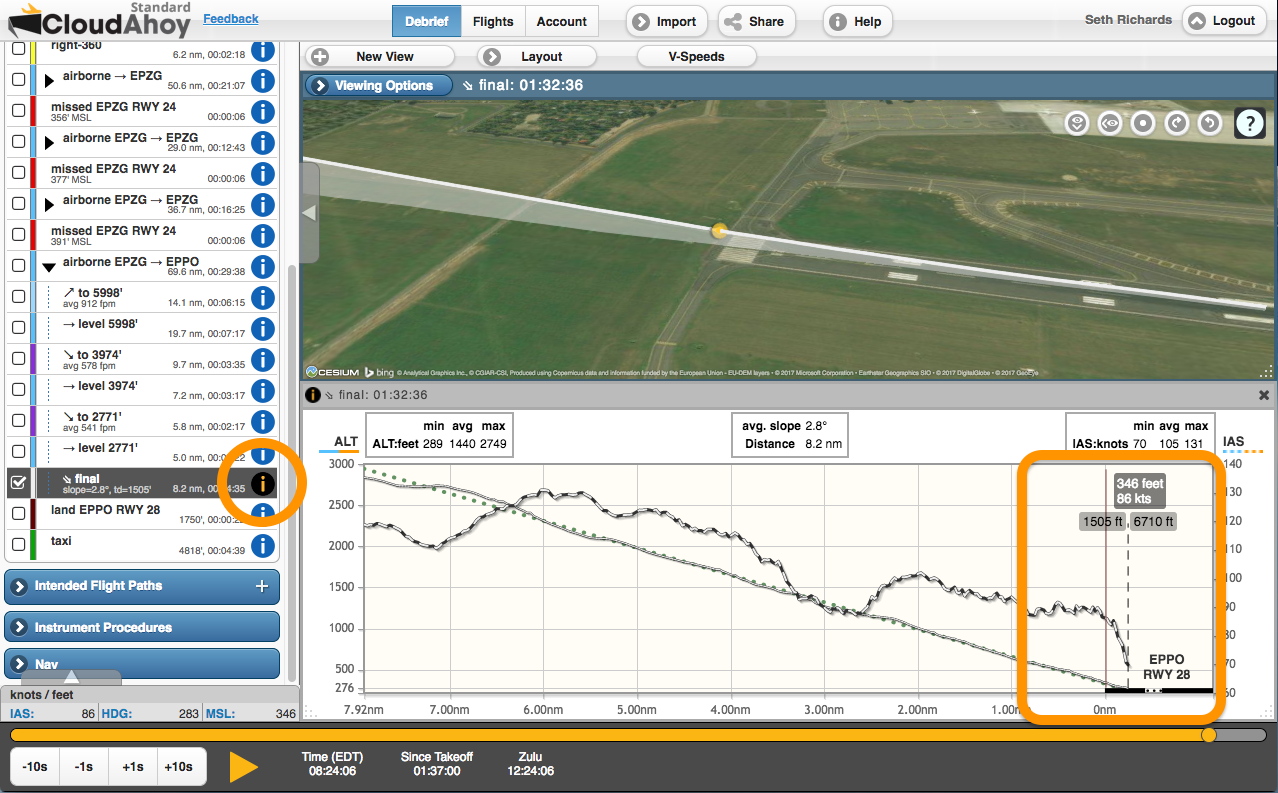
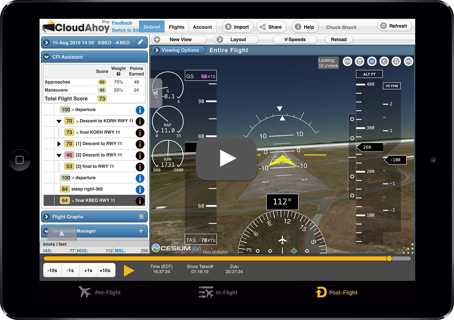
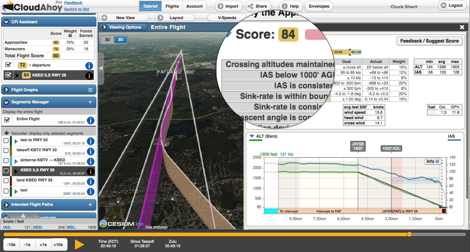
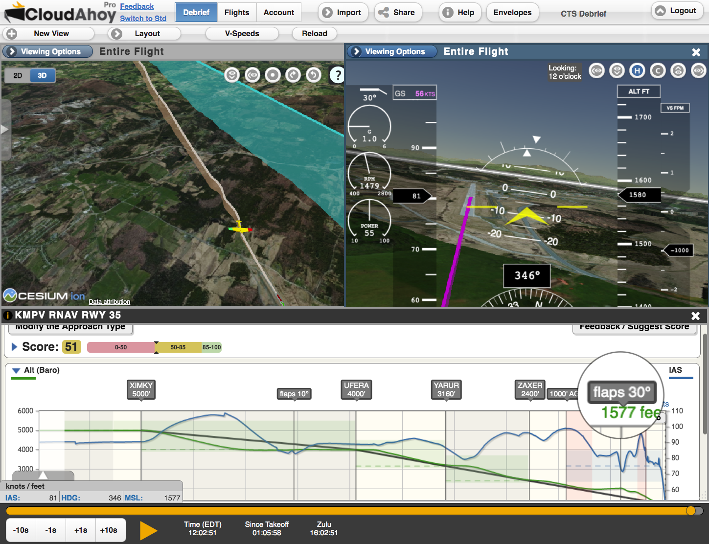
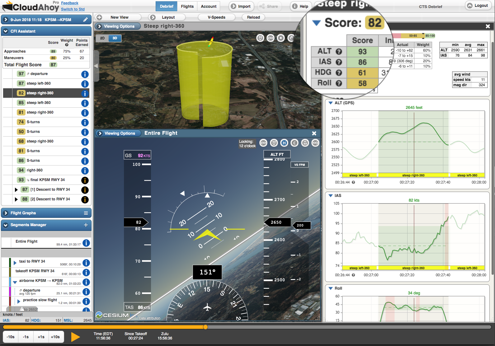
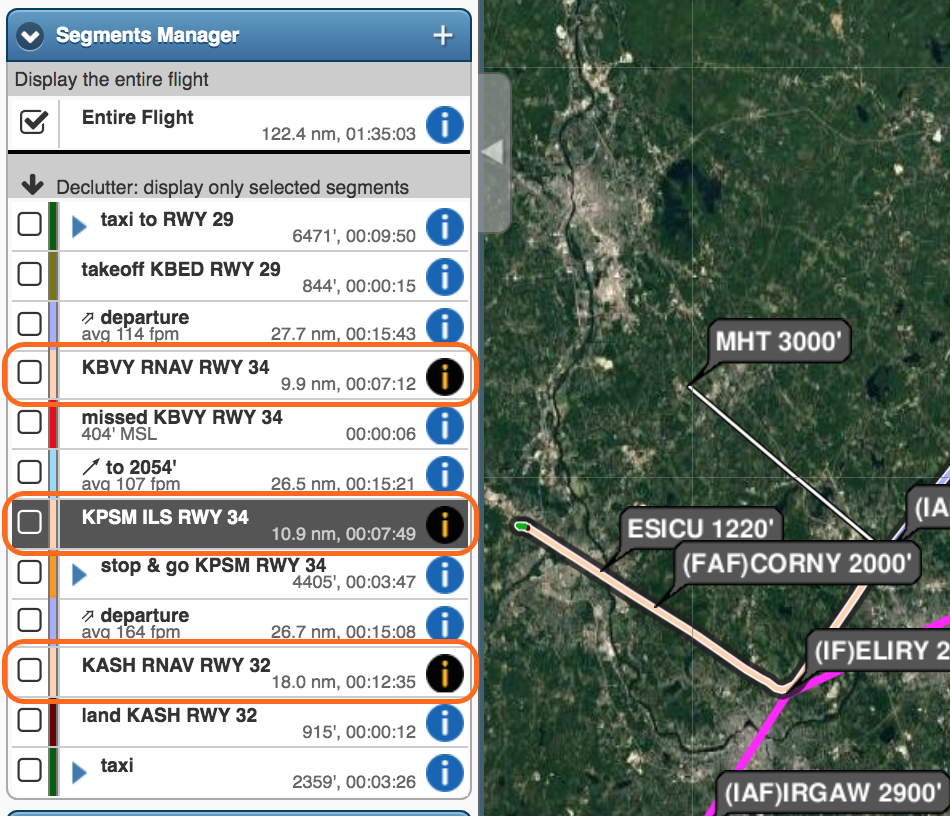
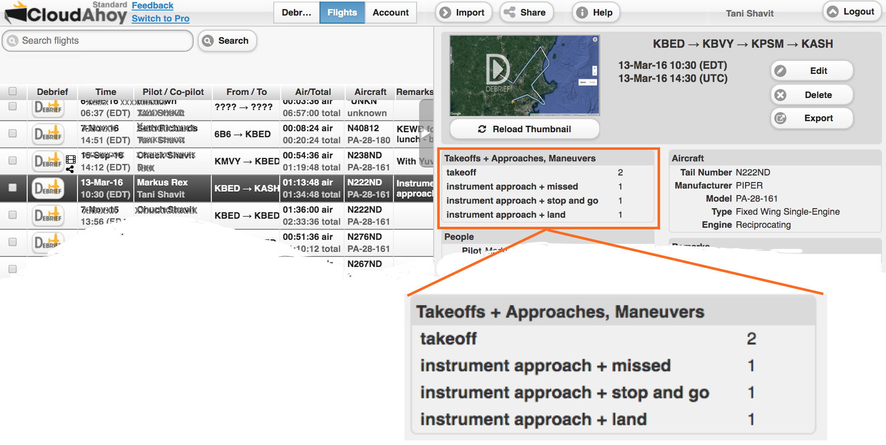
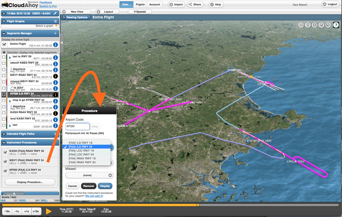
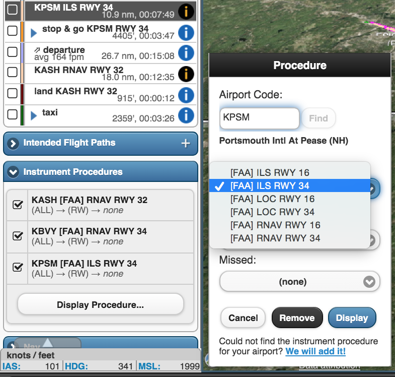
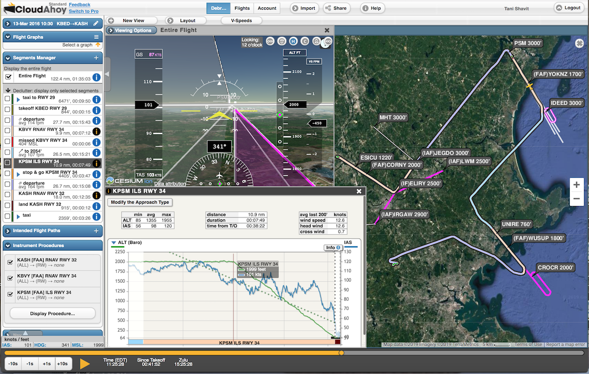
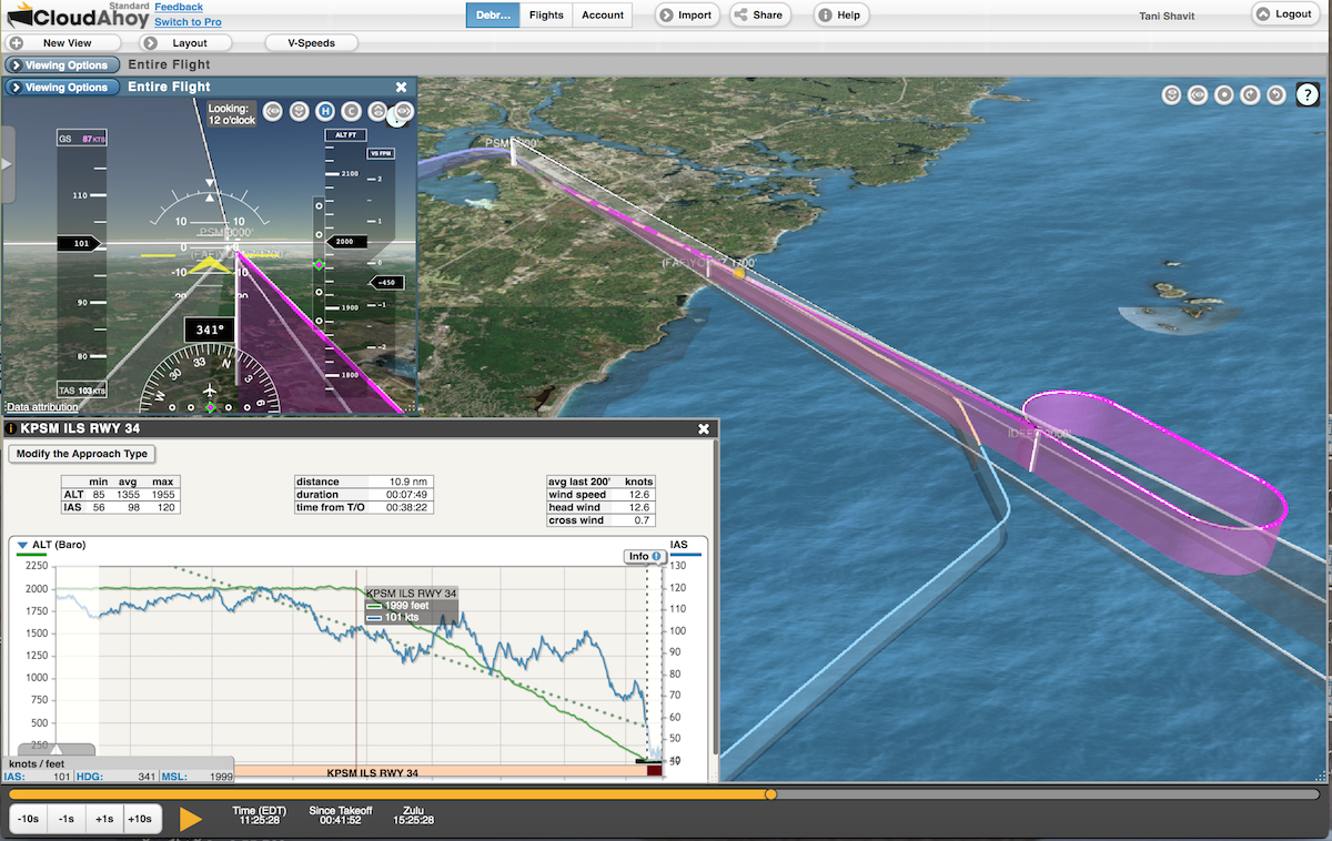
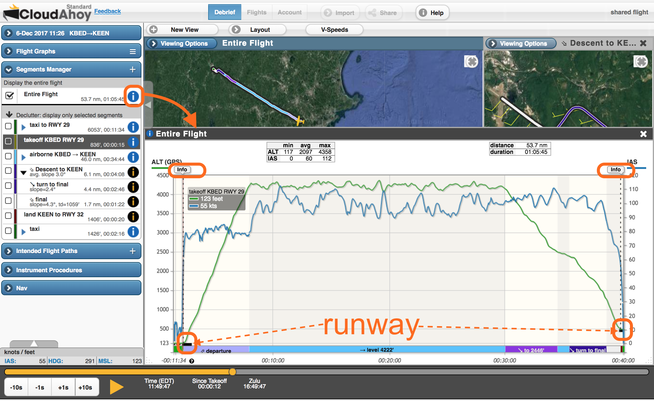
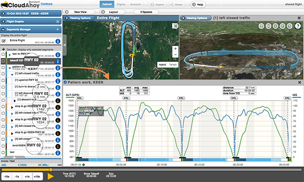
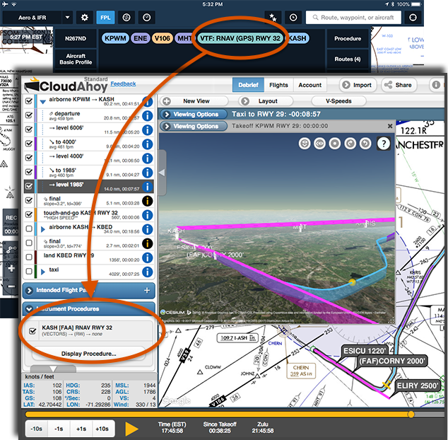
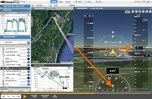
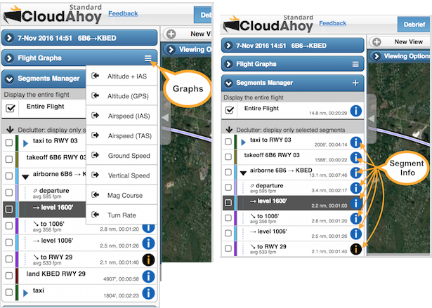
The CFI Assistant leverages the automatic flight segmentation which is part of the core CloudAhoy technology. It scores individual maneuvers as well as the entire flight. The user interface and visualization enables drilling down and highlighting areas for improvements, using smart graphs and visualization.
“The CFI Assistant is released after more than two years of development.” says Shavit. “We combed through data from thousands of flights, and received valuable feedback from beta testers in the military, flight schools and individual pilots.”
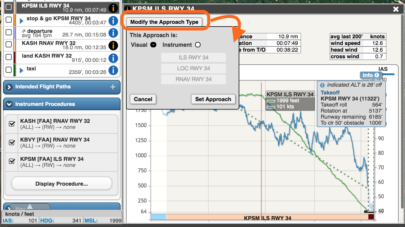
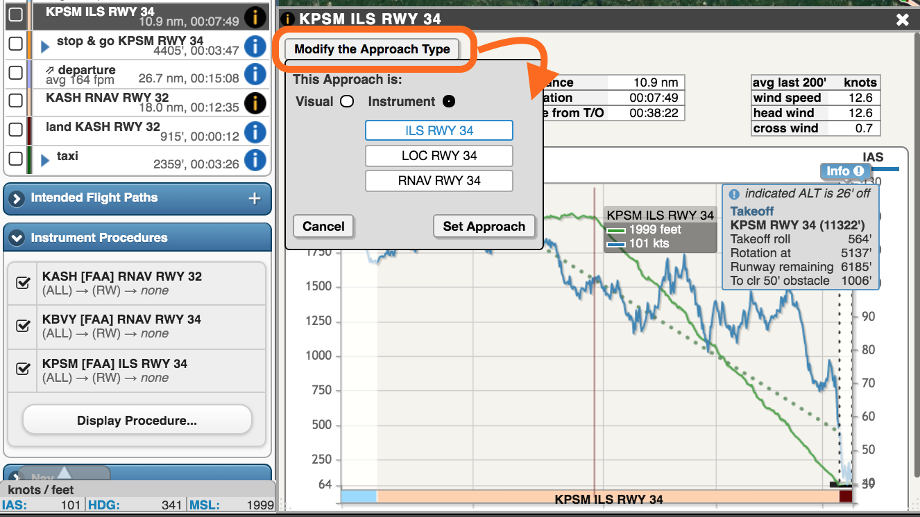
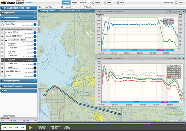
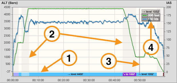
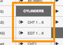
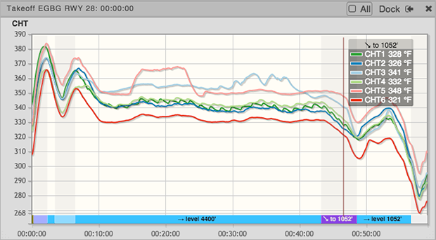
Additional capabilities of CloudAhoy Pro include detailed analysis of instrument approaches, and advanced display of gauges when data is available – such as power settings, G force, flaps, gear, etc.
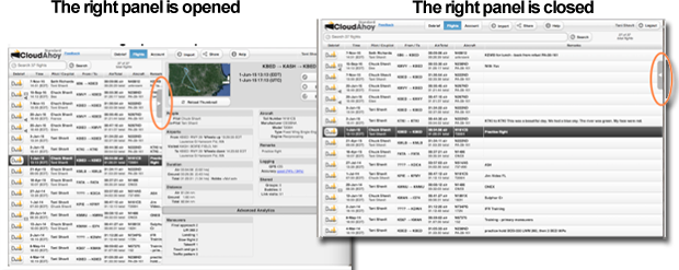
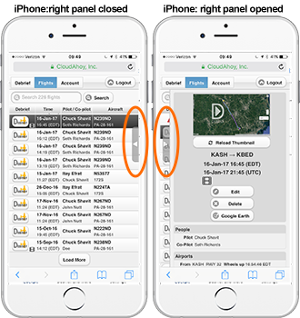
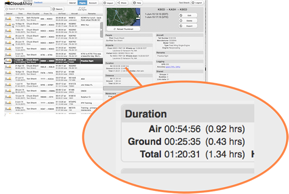
CloudAhoy 6.0 has many additional improvements, available in both CloudAhoy Standard and CloudAhoy Pro. Those include a redesign of the iPhone interface, predefined layouts, user-friendly segments info and graphs, and other usability improvements. For more accurate analysis, hundreds of aircraft models and their parameters have been added to the aircraft models database. For organizations such as flight universities and schools, military units, airlines & business operations and alike, CloudAhoy 6.0 includes an organization manager, with subscription management, organization-wide aircraft parameters, and organization-wide customizable scoring envelopes.
CloudAhoy is running a ‘6.0 Special’ until October-23 2019, giving a one-month free subscription of CloudAhoy Pro to every CloudAhoy user, and an extra month for every purchase (12+1). “We are reaching out to all users, including early adopters of CloudAhoy” says Shavit, “to use the full Pro capabilities.“. The subscription price of CloudAhoy Pro is $150/yr, the price of CloudAhoy Standard remains unchanged at $65/yr. NAFI and SAFE members have discounted price.
About CloudAhoy
CloudAhoy builds post-flight debriefing products. It integrates flight data with information from a comprehensive suite of aviation resources, analyzes the flight using rule-based knowledge engine, and presents the analysis via detail-rich interactive display. CloudAhoy brings technology to post-flight debriefing, adding value to any flight training, enhancing the experience of flying, and helps make better pilots. This applies equally to primary, advanced, and recurrent training, and to day-to-day flight operation for self-improvement, and for fun. To learn more please visit www.CloudAhoy.com .
Contact:
Tani Shavit
VP Products & Strategy
(718) 572-5446tani@CloudAhoy.com
###
Image links attached.
Video 6.0 announcement: https://youtu.be/F4wcehDfWjw
More about version 6.0: http://www.cloudahoy.com/
CloudAhoy.com: http://www.cloudahoy.com
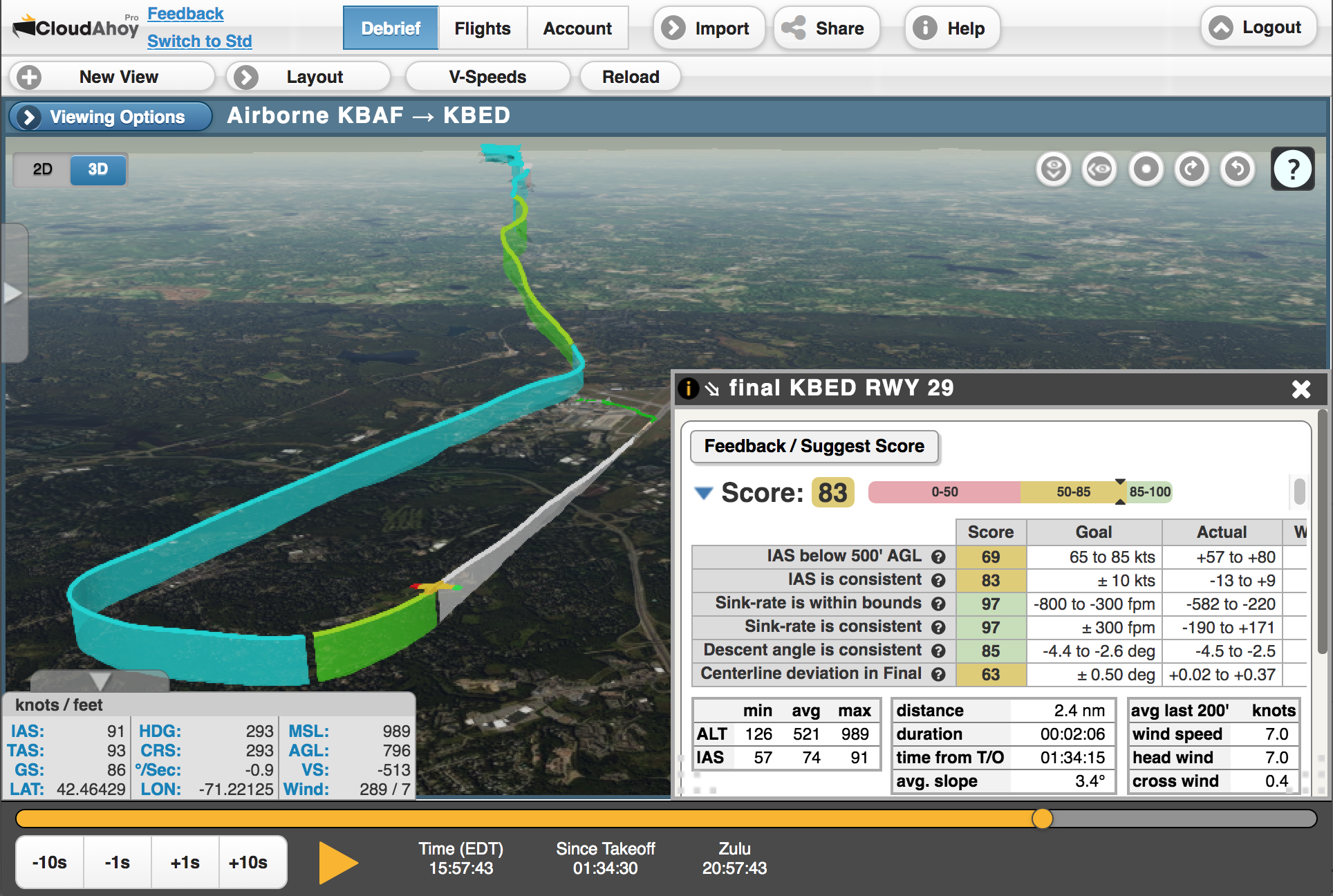
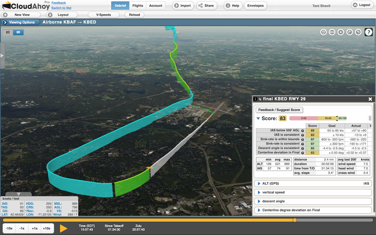
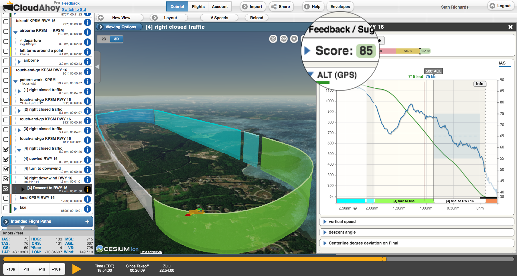
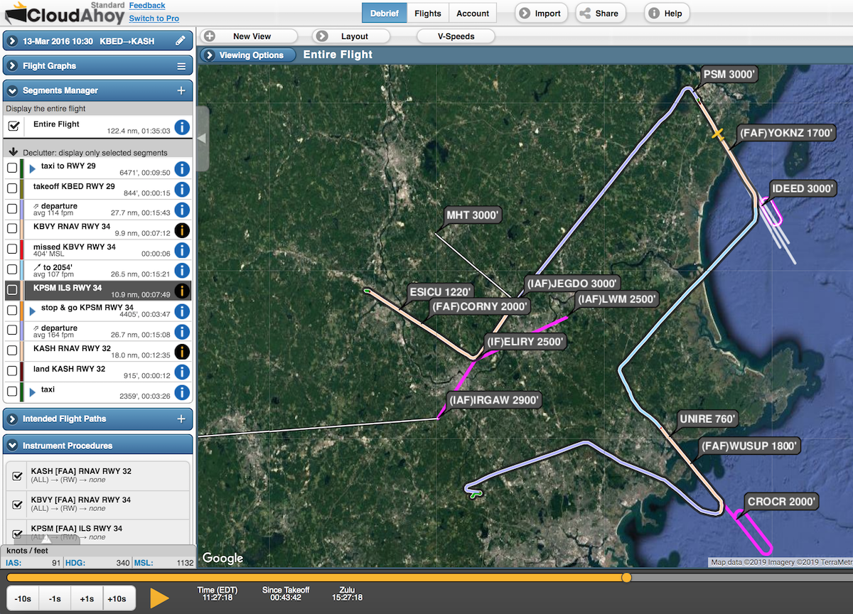

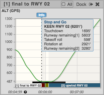
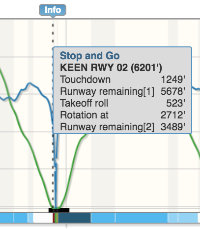
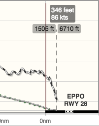 How precise are your landings?