We released CloudAhoy 5.0 on Valentine’s Day, February 14 2017.
What is “CloudAhoy 5.0 Special” ?
Each and every user gets a FREE MONTH of CloudAhoy Standard. The “5.0 Special” ends today, March 14 2017.
What is CloudAhoy 5.0?
It’s a new generation of our power debrief tool, available to all CloudAhoy users – whether you debrief on the web (Windows, Mac, Android, Linux) or in our iOS apps.
Highlights
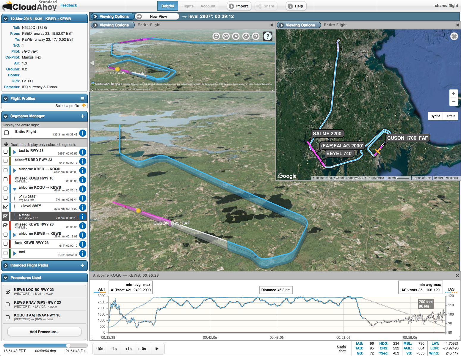
- New Approach analysis: check how stabilized your approach was
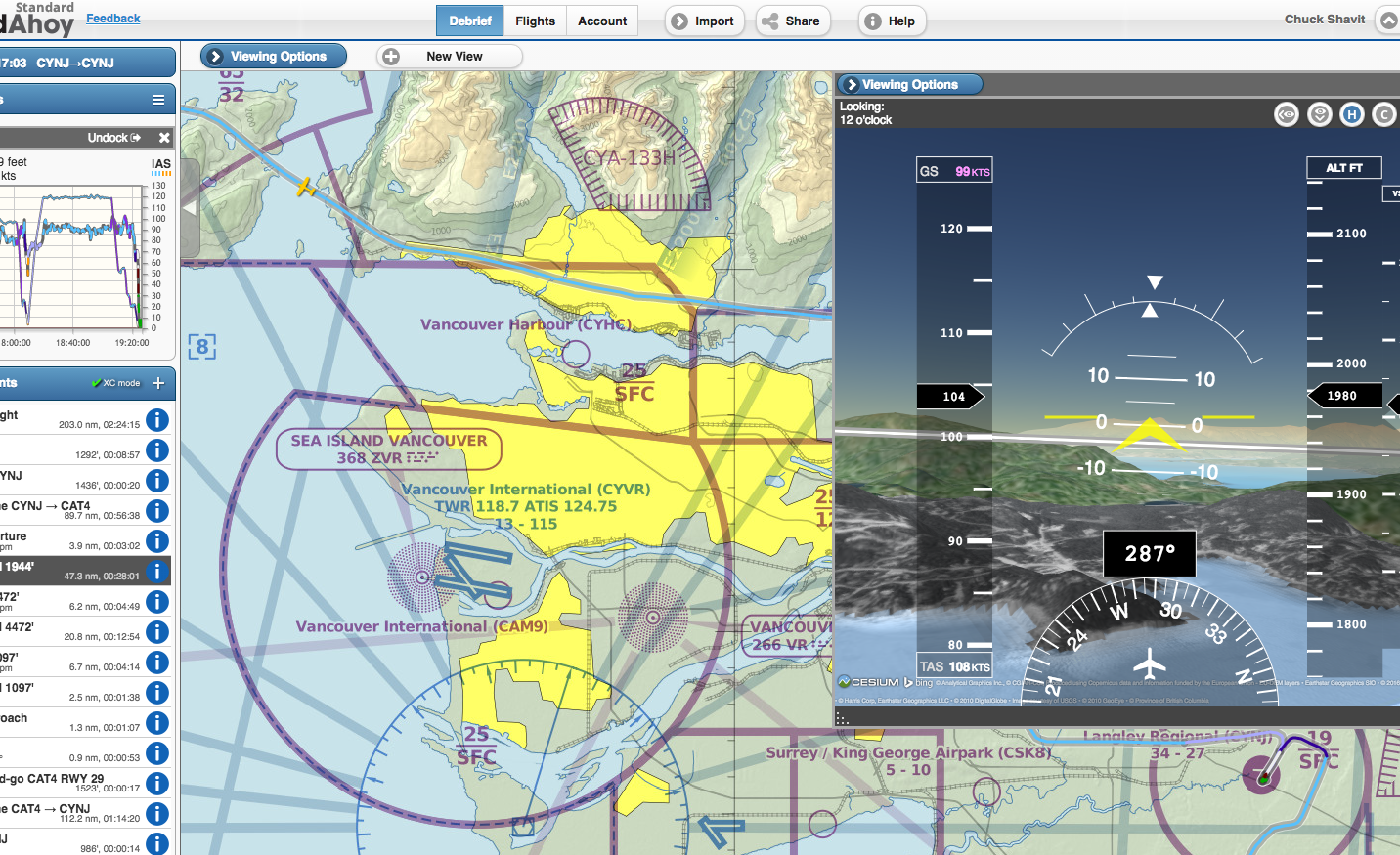
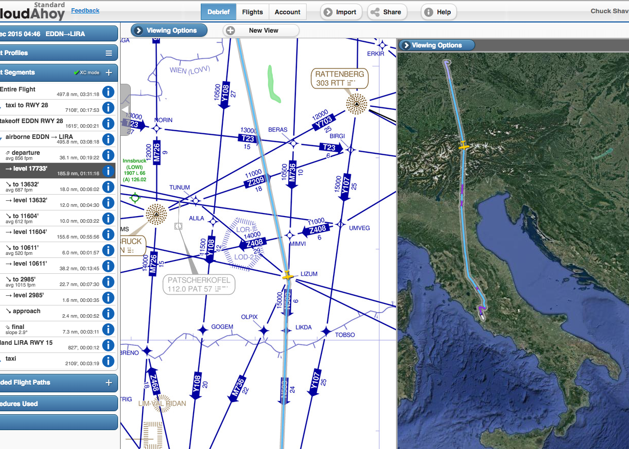
Our enhanced flight analyzer detects, computes and displays approach information. - New VFR / IFR charts, worldwide
We partnered with SkyVector to provide high quality and up to date charts. - Redesigned Flights tab
Including a powerful flight search, thumbnails, and manuever list per flight.
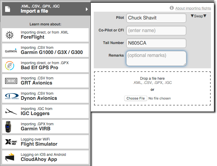
We also released a new version of our iOS app, supporting pilot roles: you can now specify the role of each pilot (e.g., co-pilot, CFI) and whether he or she are the PIC. A new version of our Android app is in the making.