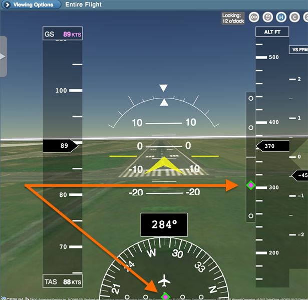
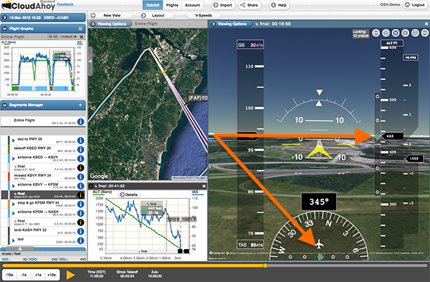
If you import your flights from Garmin G1000, your can now view the horizontal and vertical CDIs on CloudAhoy’s glass cockpit gauges. It is useful for debriefing the accuracy of your navigation, and specifically your flying of instrument approaches.
The screenshot below shows the short final of an ILS approach. The horizontal CDI is centered (i.e., the aircraft is on the runway’s extended center line), and the vertical CDI shows the aircraft above the glide slope.


Note that if you fly a non-precision approach, then the vertical CDI will not be displayed. Also, the horizontal and vertical CDIs are not displayed when there is more than full-scale deflection.
Is the Cockpit Display mode able to be seen in Real time mode, ….if stuck on top….. or only seen as a debrief tool
Ron, if I understand your question correctly – CloudAhoy is a post-flight debriefing tool. Cannot be used in flight.
i saw someone , Keith Smith from”pilot workshop” using it as a live on line assist to help
him navigate in near IFR conditions, or so it appeared. it seems as if you can open up “ google
earth “ and use a GPS to add info and your are good to go? sort of .
Hi Ron,
Keith uses CloudAhoy for debriefing his flights, after landing. Not during the flight.
Could it be used during flight ?
only you can say…., it would be a wild thing to have it simultaneously hook to Foreflight or Garmin
and achieve real time presentation. just sayin’